What happened in the High Tatras as glaciers retreated and the climate warmed? The answers lie hidden in layers of sediment at the bottom of mountain lakes. An international study involving Roberta Prokešová reveals that individual lakes responded differently to climate change.
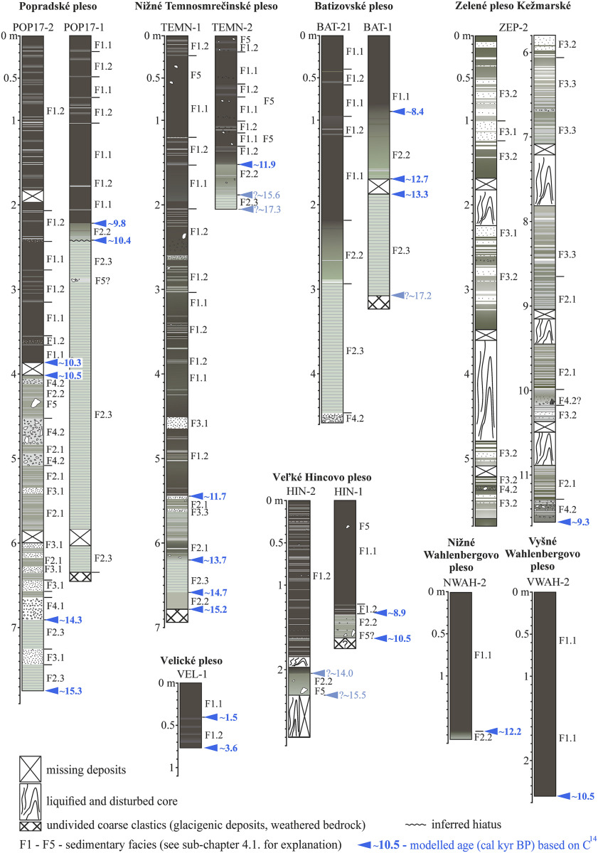
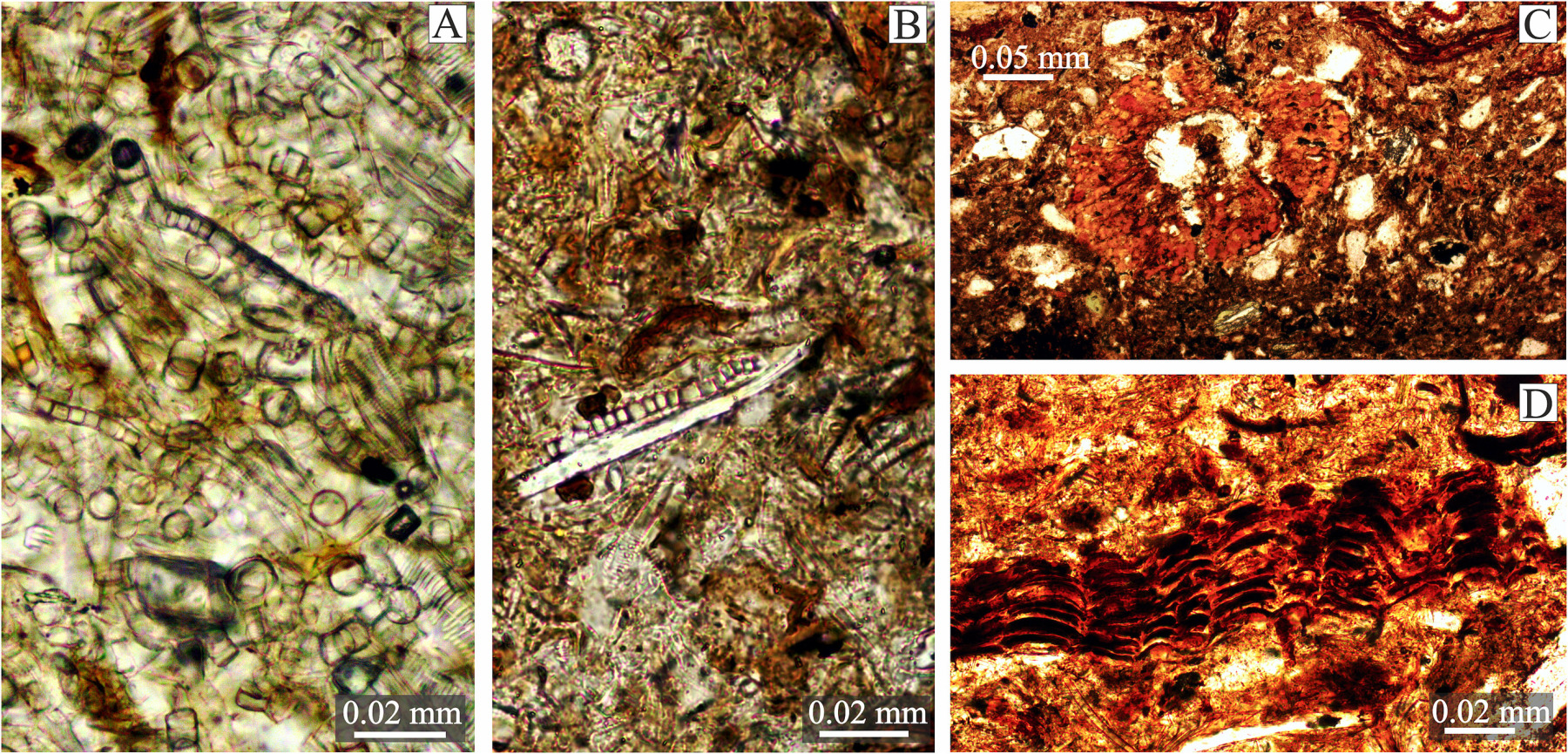
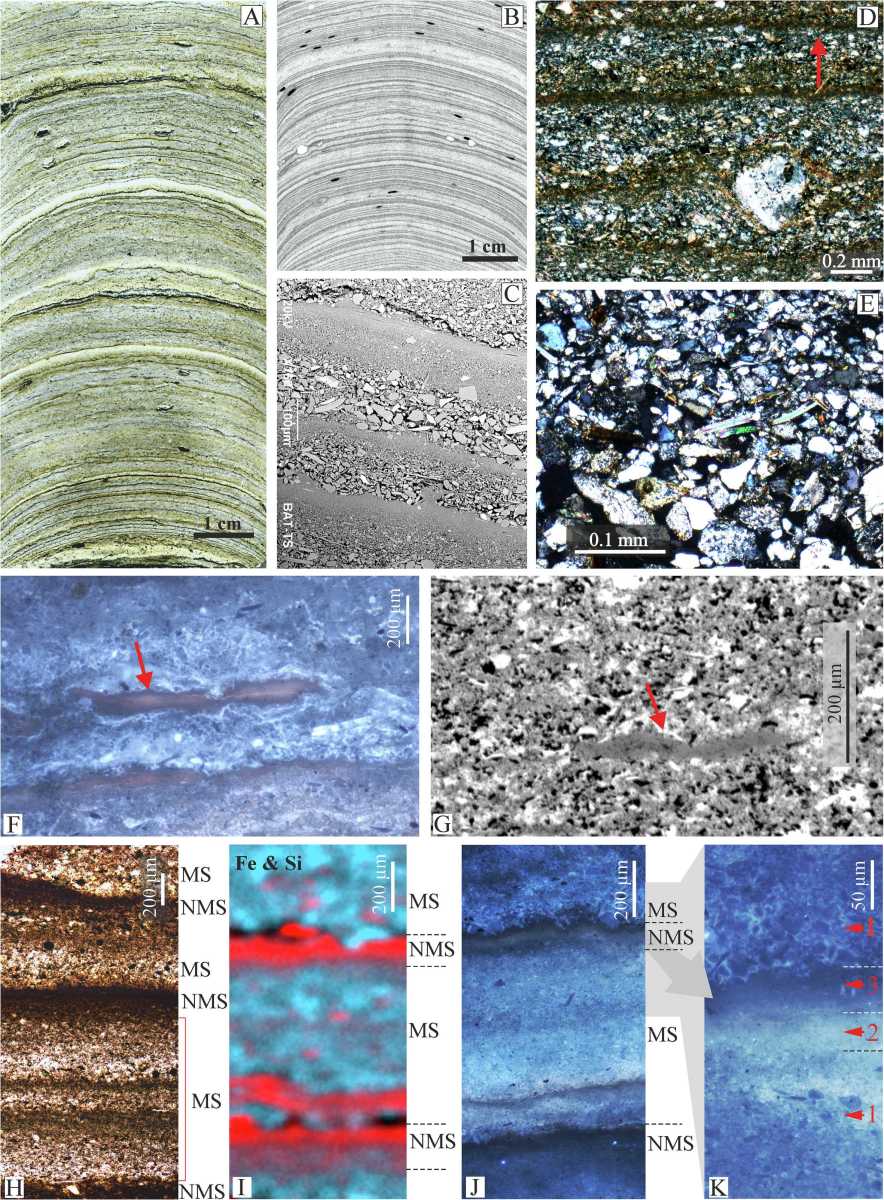
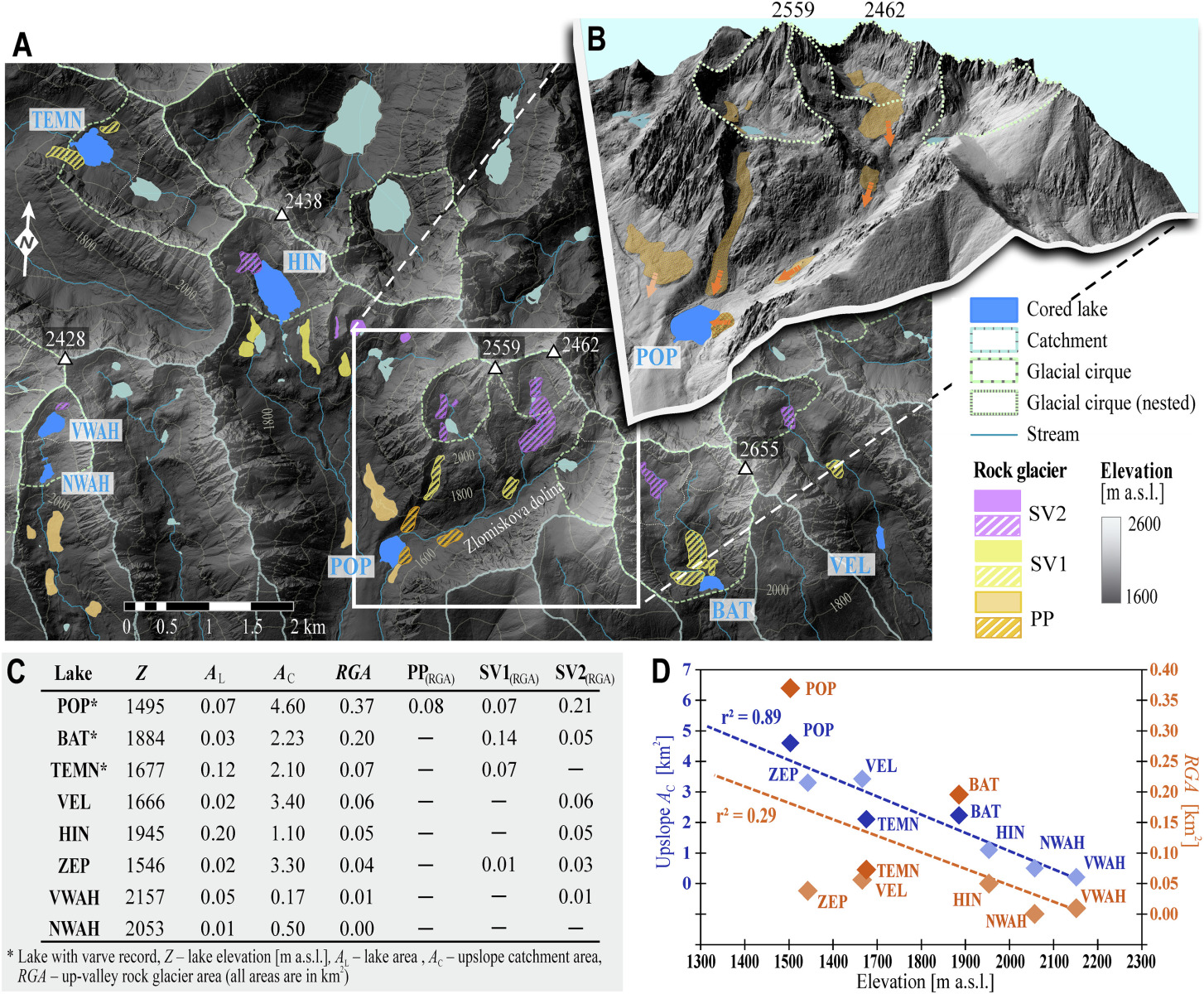
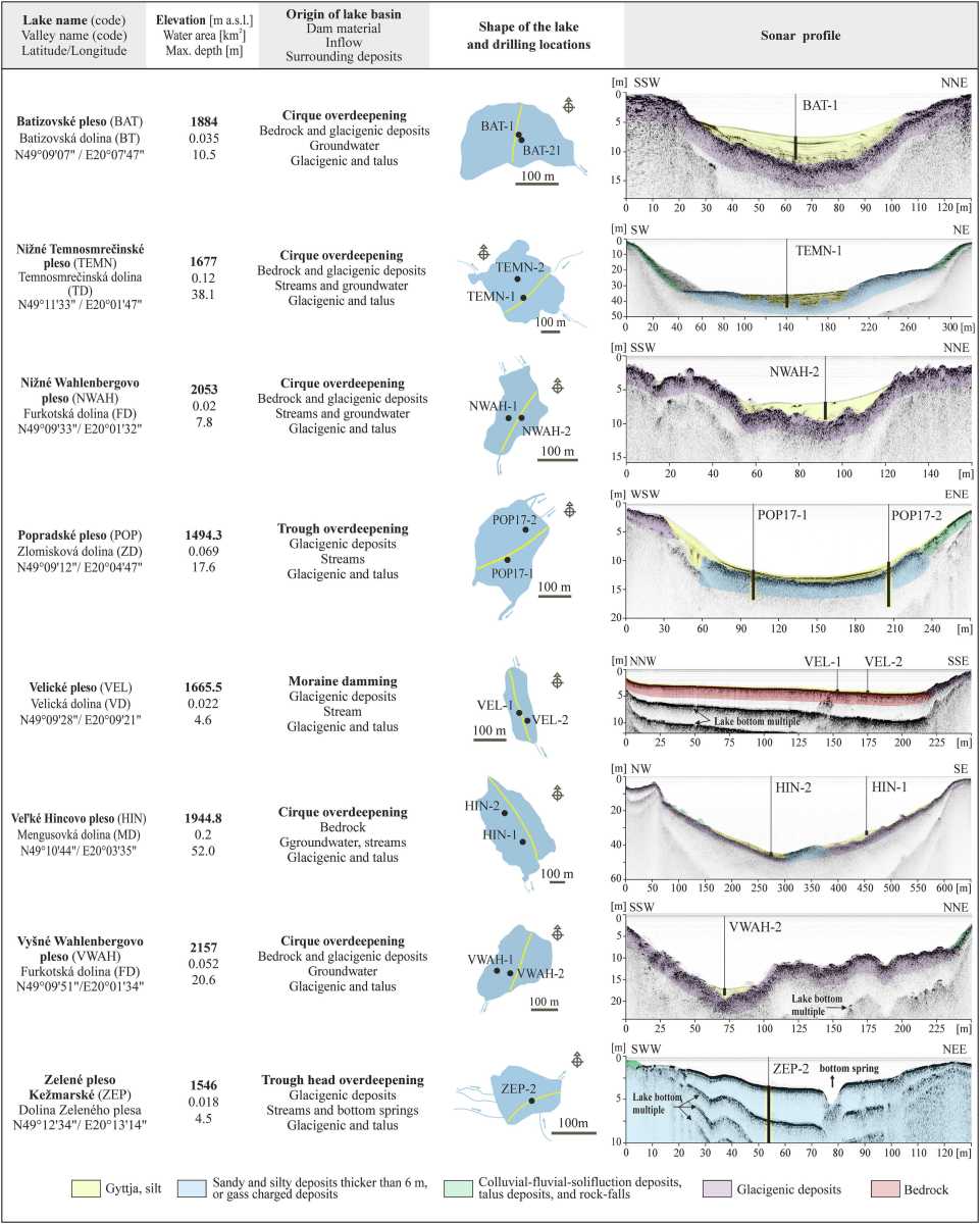
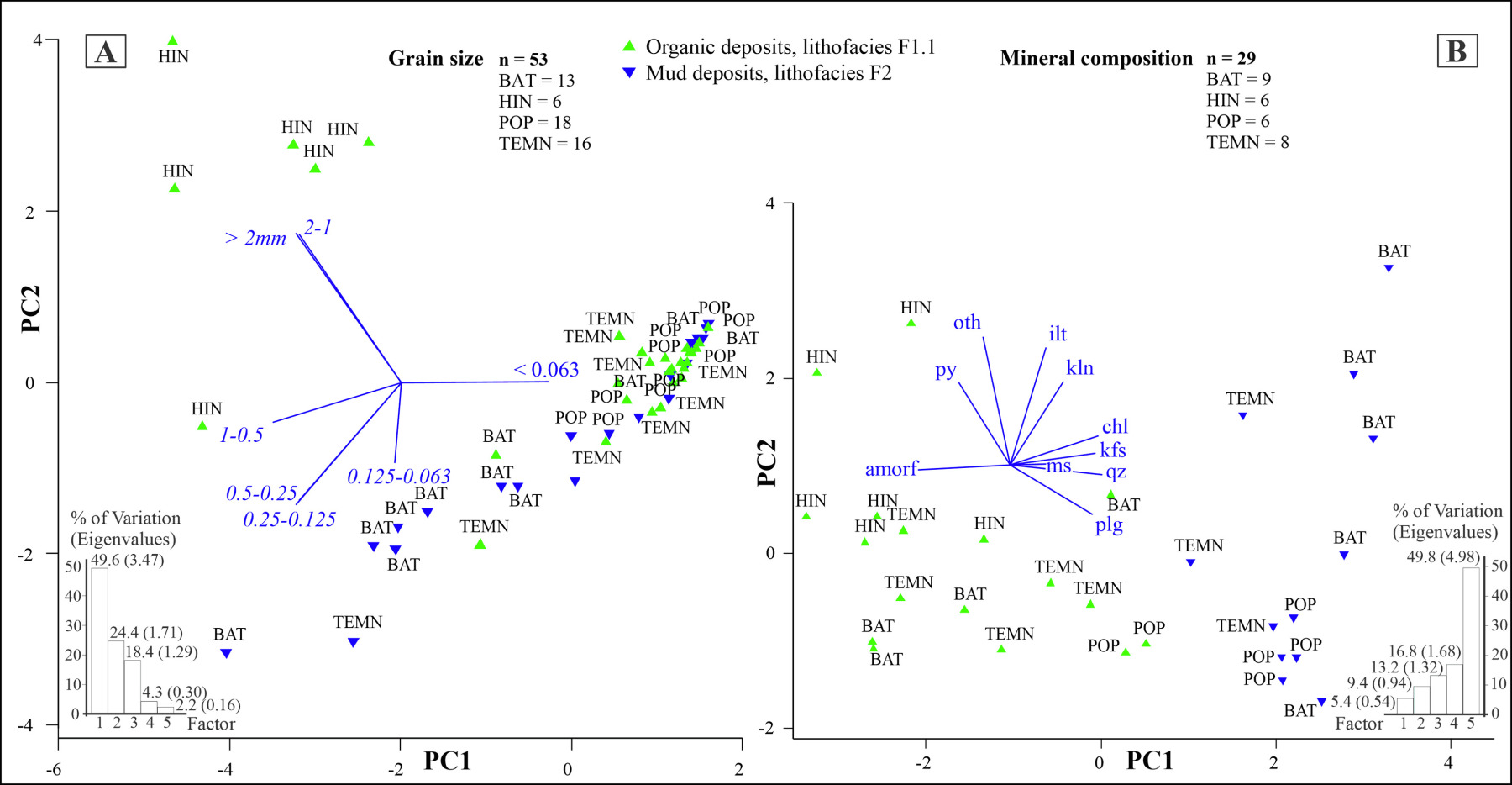
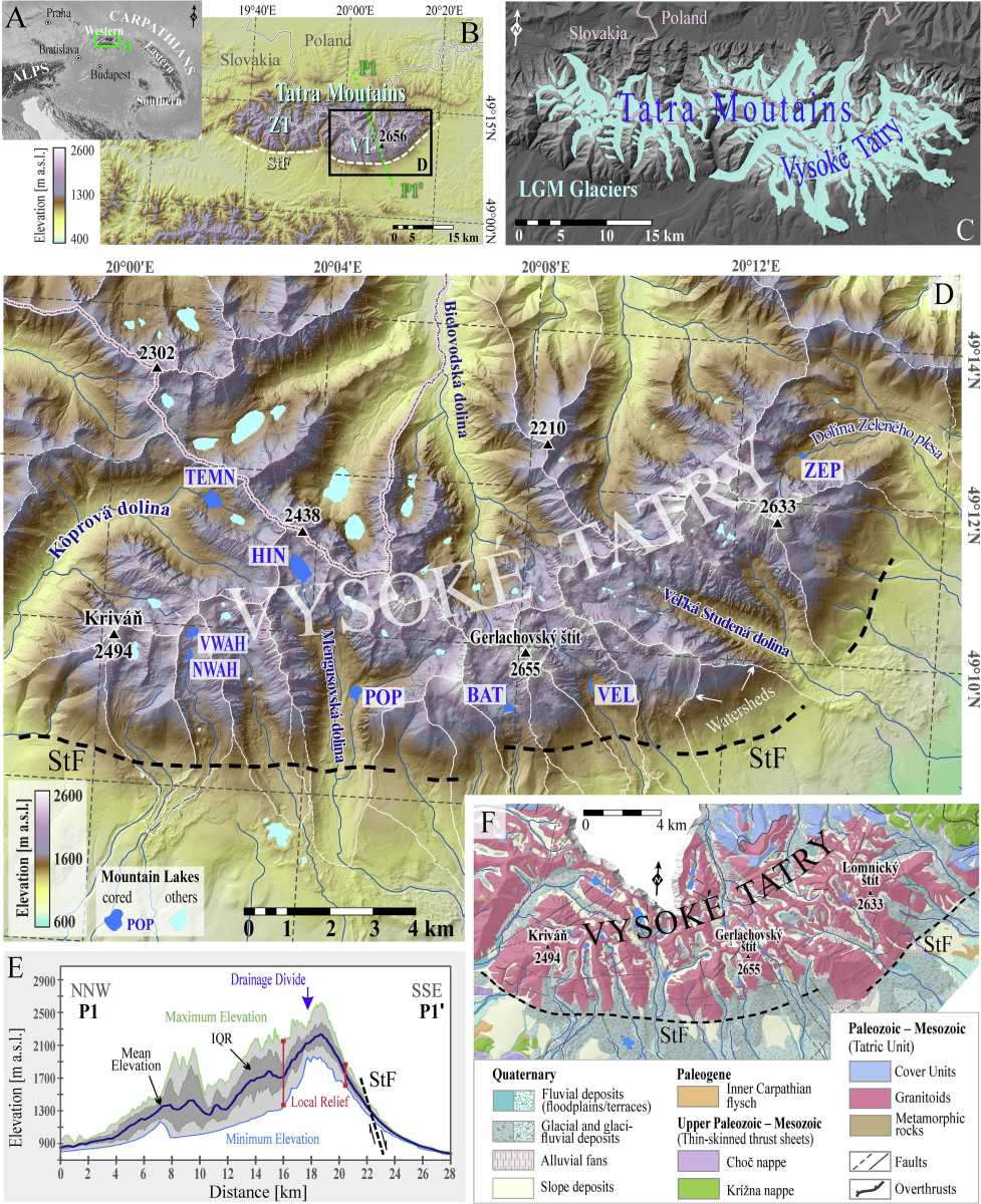
The researchers analysed sediments from eight lakes in the High Tatras. They combined detailed sediment descriptions, multiple environmental proxies and radiocarbon dating. Layers of mud, silt and clay provide an indirect record of the environmental conditions that prevailed during the Late Glacial and Early Holocene periods.
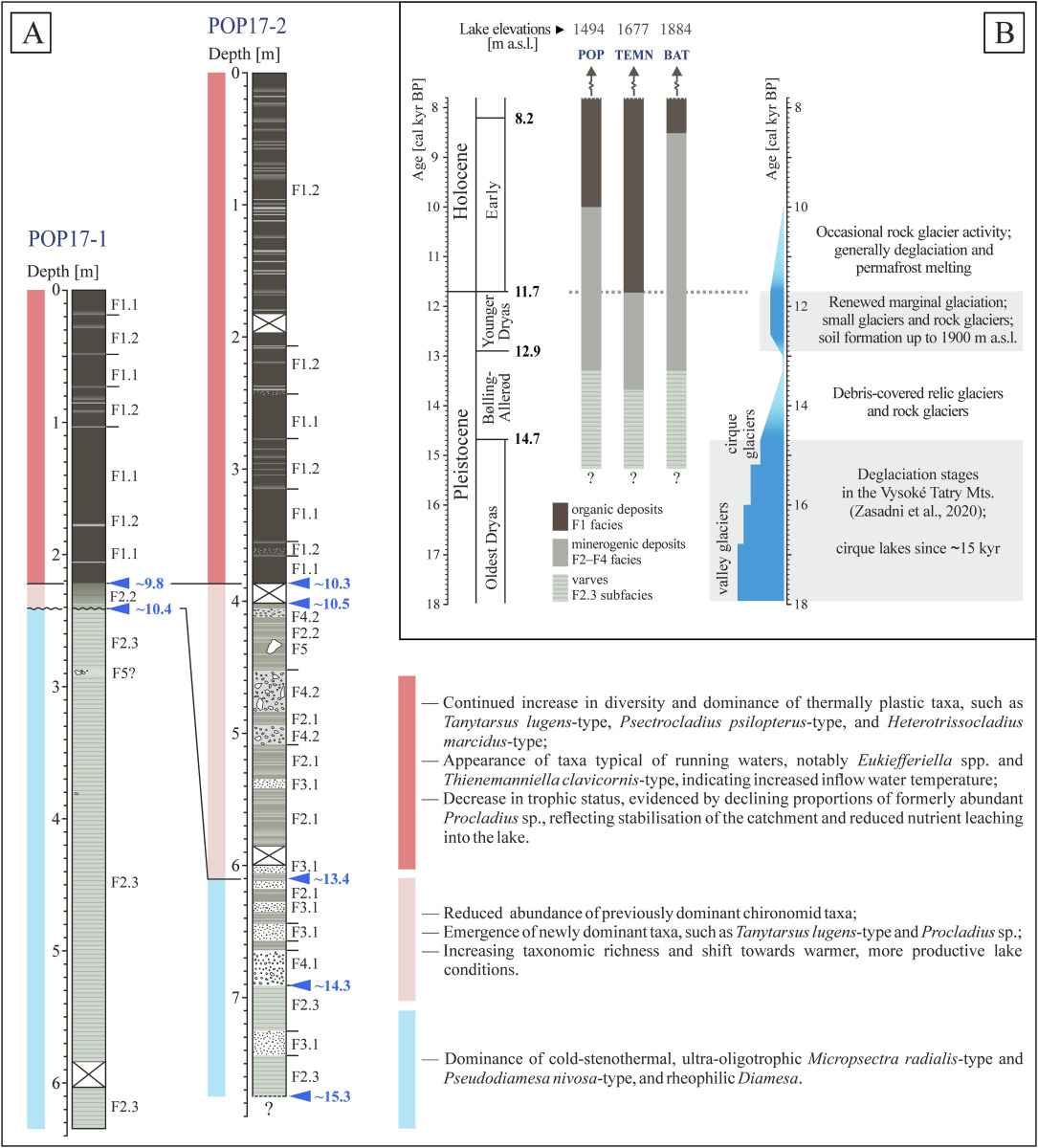
Older deposits contain finely laminated mineral sediments, whose variations the authors also associate with changes in meltwater sources and environmental conditions. However, the transition to sediments richer in organic matter did not occur simultaneously across the lakes. The study estimates that this transition took place at different times, approximately between 12,200 and 8,400 years before present.
This suggests that regional climate alone cannot explain all the observed differences. Each lake’s response was also influenced by the characteristics of its catchment, the surrounding topography and the lake basin’s morphology. The findings contribute to a more accurate interpretation of natural archives and help reconstruct the evolution of mountain landscapes following glacier retreat.
Why It Matters
- For climate research: Lake sediments provide valuable evidence of environmental changes over thousands of years.
- For geomorphology: Similar climatic changes can leave different sedimentary records in different mountain catchments.
Publication: Starek, D. et al. (2026). Variable responses to the Late Glacial–Early Holocene climate change in the Tatra Mountains (Western Carpathians) inferred from lacustrine sediments. Palaeogeography, Palaeoclimatology, Palaeoecology, 701, 114149. IF 2025: 2.9; JCR 2025: Paleontology 3/58 (D1).
Link: https://doi.org/10.1016/j.palaeo.2026.114149
This research was supported by the following project:
- VEGA 2/0014/25 — From Digital Topography and Geomorphometric Indices to Erosion and Uplift Rates
Prepared by: Tomáš Goga | With the assistance of GPT-6 Astra.