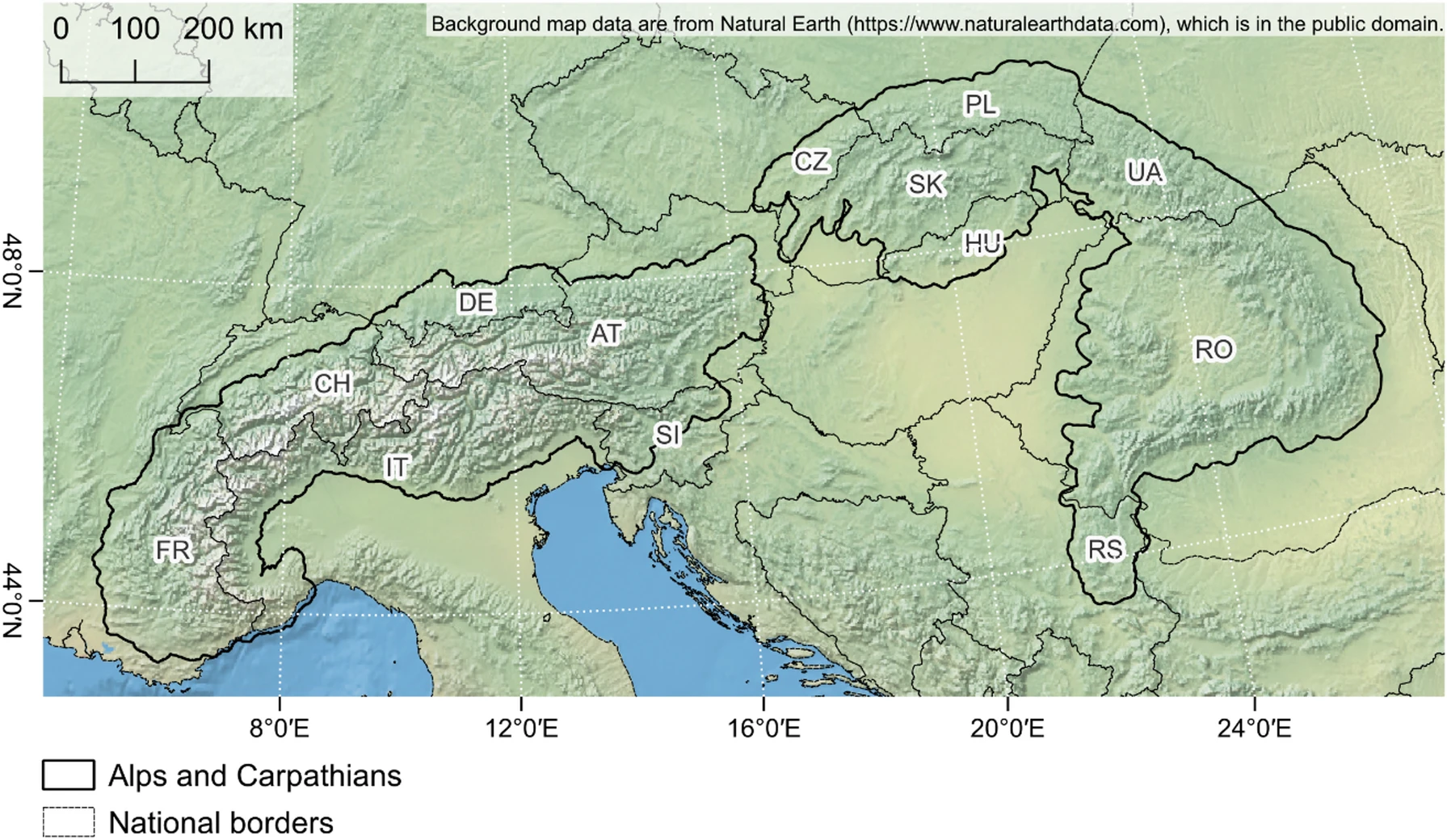
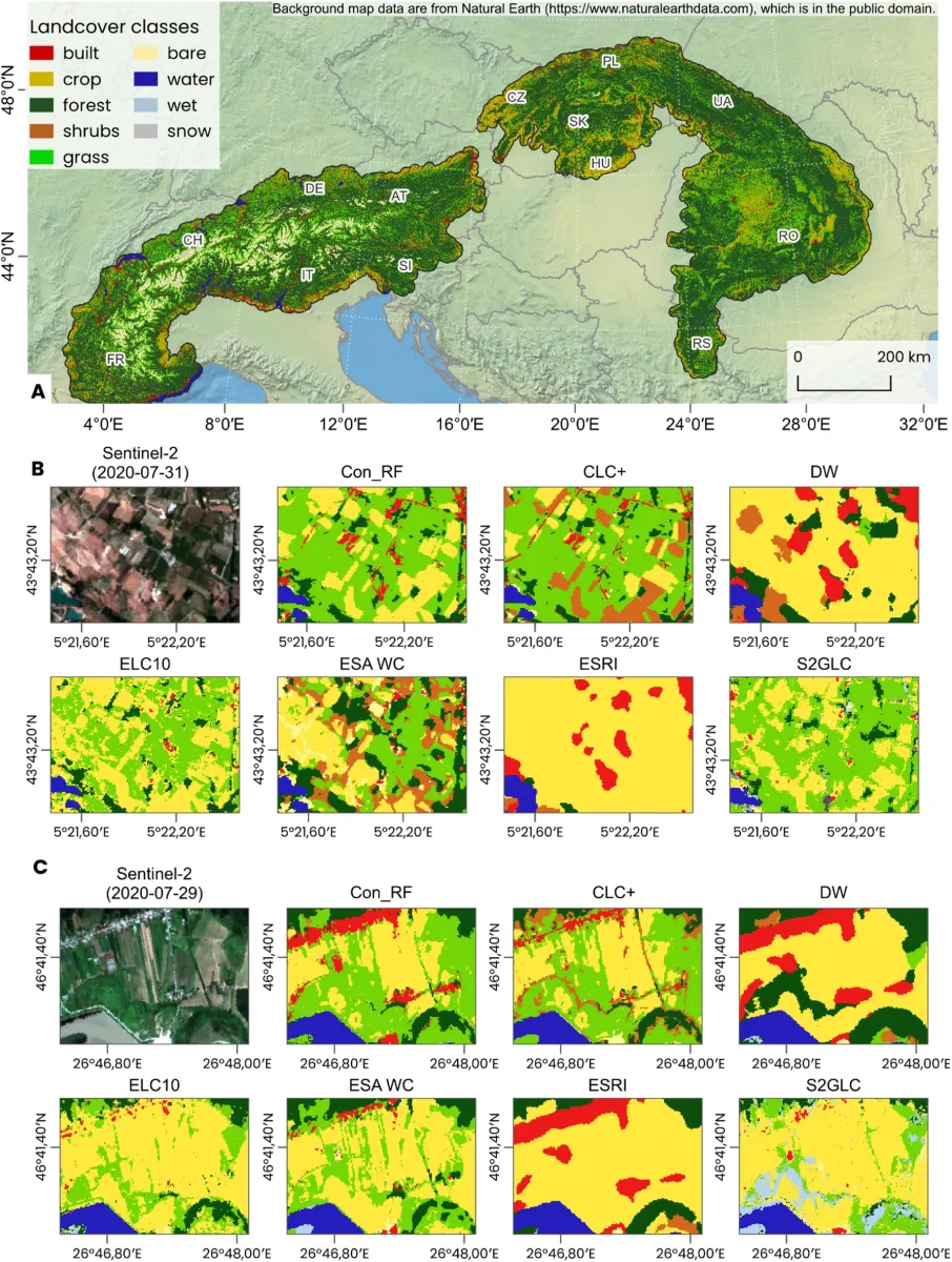
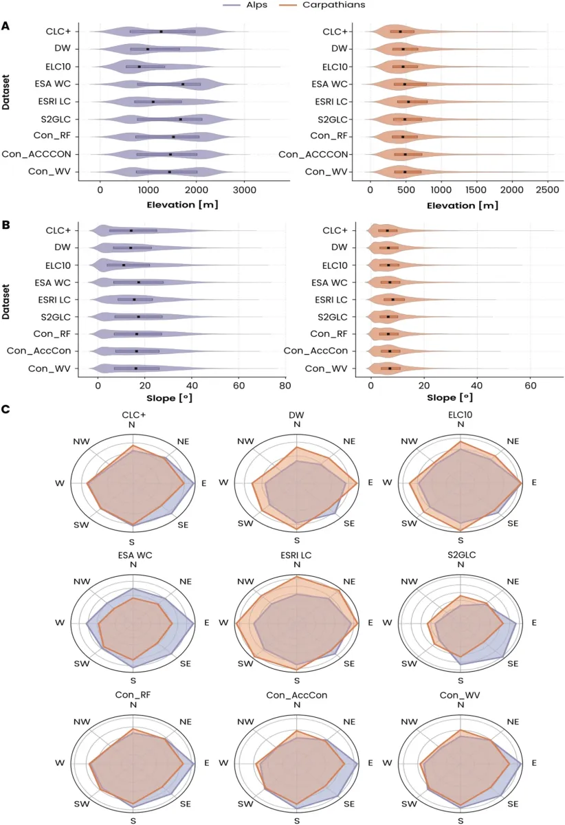
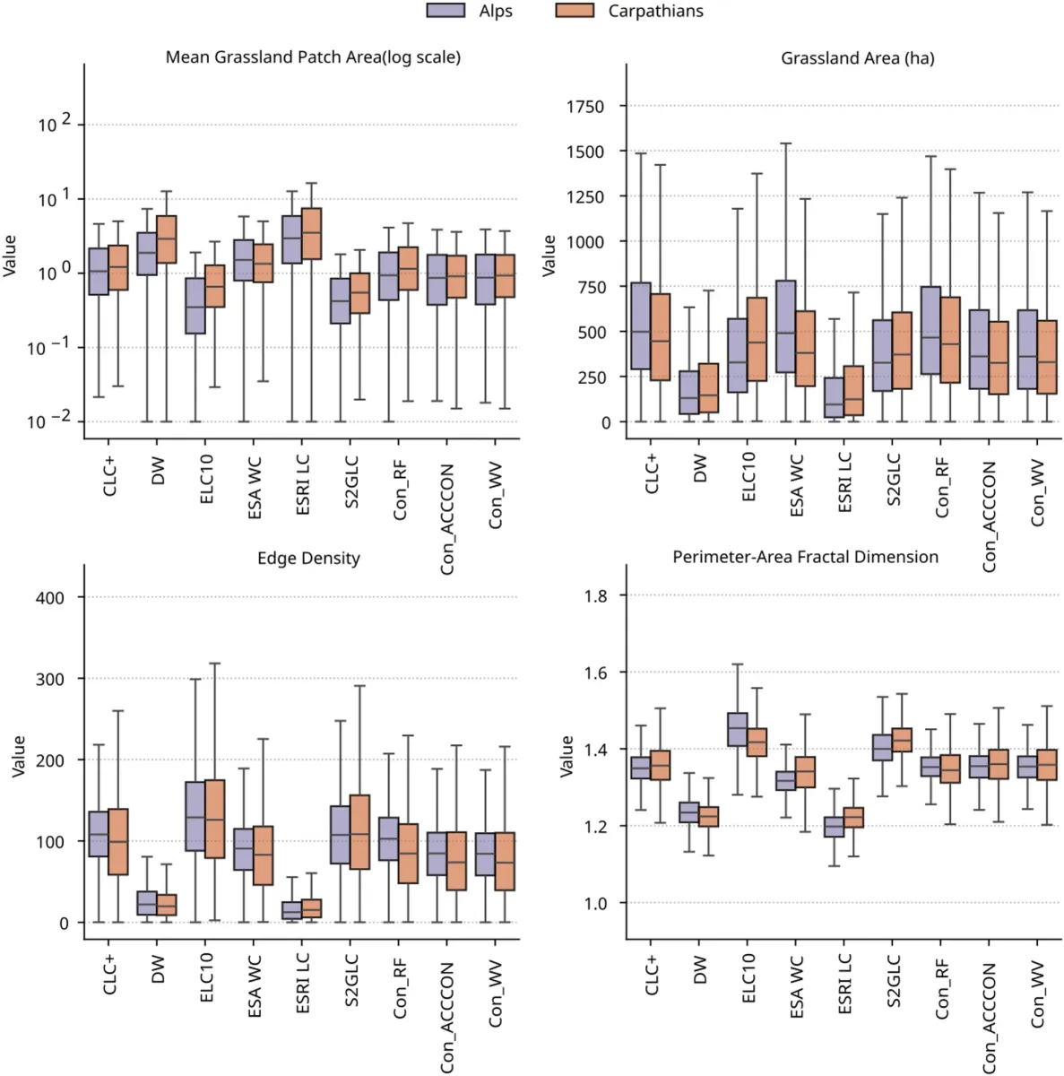
The same landscape can look completely different across satellite-derived land-cover products. Our colleagues compared six land-cover mapping products in the Alps and Carpathians and demonstrated that intelligently combining them can significantly improve grassland mapping accuracy.
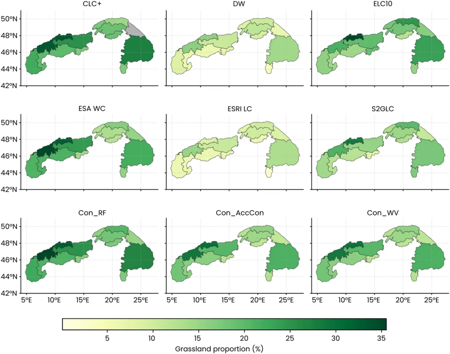
Grasslands play an important role in biodiversity conservation, yet mapping them accurately remains challenging. Several global and European land-cover products are available, including Dynamic World, ESA WorldCover, Esri Land Cover, Corine Land Cover+ Backbone, ELC10, and S2GLC. The authors found substantial differences between these products, both in their estimates of grassland extent and in how they represent landscape structure.
The research team, led by Šimon Opravil, tested three consensus-based methods that integrate information from multiple land-cover maps. The most successful approach used a Random Forest ensemble model, with input products weighted according to their accuracy.
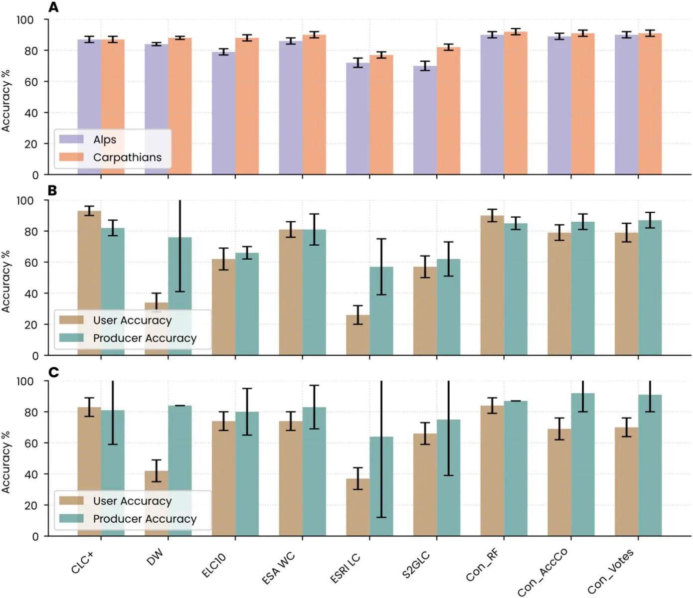
The resulting overall accuracy reached 90–92%, while accuracy metrics for the grassland class exceeded 84%. The combined maps also showed better consistency with elevation and slope gradients. These findings have important implications for biodiversity assessment, landscape change monitoring, and the use of land-cover products in environmental decision-making.
Why it matters
- For nature conservation: more reliable maps help identify and monitor grassland habitats.
- For geoinformatics: combining multiple independent mapping sources can produce more accurate results than relying on a single product.
Publication: Opravil, Šimon; Baumann, Matthias; Goga, Tomáš; Afzali, Hamid; Kuemmerle, Tobias; Pazúr, Róbert (2026). Consensus land-cover mapping improves grassland classification in European mountain landscapes. Scientific Reports, 16, 8077. 2025 Impact Factor: 4.9; Q1 JCR.
Link: https://doi.org/10.1038/s41598-026-39197-w
This publication was supported by research conducted within the following projects:
- APVV-21-0226: Species-rich grasslands of the Carpathians: mapping, history, drivers of change and conservation
- VEGA 2/0043/23: Detection of landscape diversity in Slovakia and its changes using remote sensing data in the context of the European Green Deal
Prepared by: Tomáš Goga | With the assistance of GPT-6 Astra.