How to work with the mobile network data topology? And how to deal with questions about their extrapolation to the whole population? These questions were addressed by a team of authors from the Institute of Geography of the Slovak Academy of Sciences and the Faculty of Science of Comenius University.
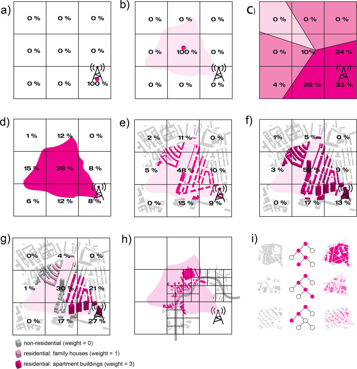
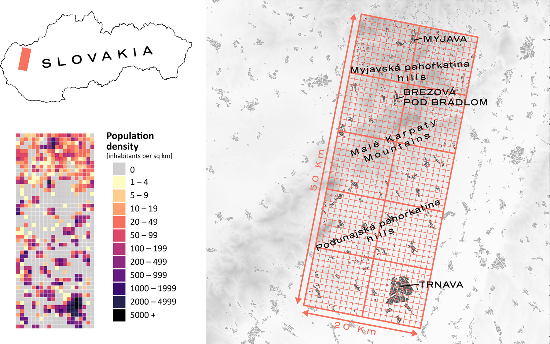
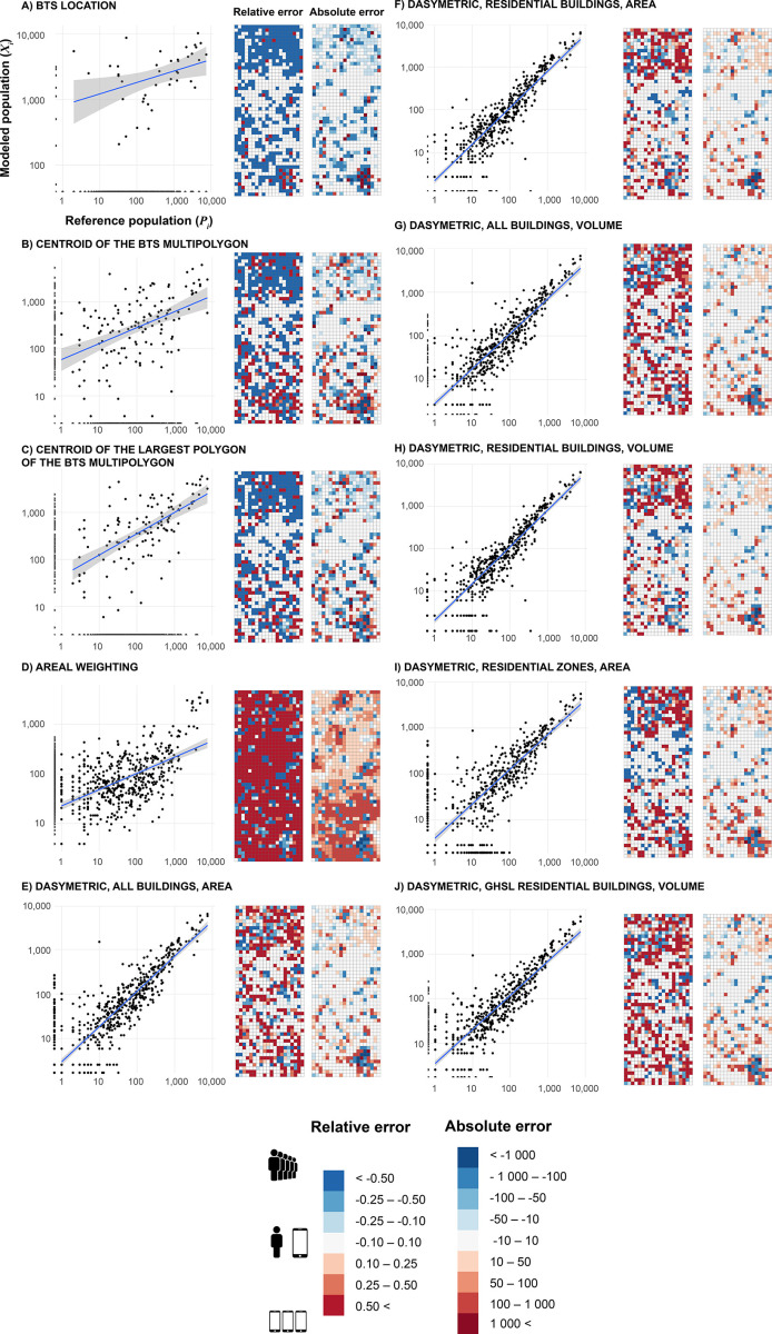
Mobile network data is becoming an increasingly frequent source for various analyses in geography or transport. However, for practical use in spatial analyses, mobile network data must be meaningfully transformed into spatial units, most often administrative units (municipalities, districts, etc.). Despite the rapid development of the problem of processing these unique data, there have so far been few attempts to address the spatial interpolation of location data from mobile devices and the problems associated with extrapolating these data to the entire population. The team of authors led by Mgr. Martin Šveda, PhD. has tested several methods of transforming data from mobile network beamforming polygons into a regular 1 x 1 km grid. The method that uses the volume of buildings in the transformation proved to be the most accurate. Conversely, a frequently used method that relates the location of the mobile device to the location of the cellular network antenna was found to be significantly inaccurate at the kilometre grid level.
The article When spatial interpolation matters: Seeking an appropriate data transformation from the mobile network for population estimates was published in Regional Environmental Change (Elsevier) – IF 2022: 6.8
The article is part of the research projects:
- APVV-20-0586: Mapping Population Distribution and Mobility in Slovakia Using Mobile Network Data
- VEGA 2/0008/24: Social and Spatial Aspects of Transport Exclusion in Slovakia