How are new technologies helping to understand the degradation of the last natural multi-channel river in Slovakia? Learn how aerial photography, laser scanning, and UAV mapping are helping solve the problem of incision in the Bela river bed.
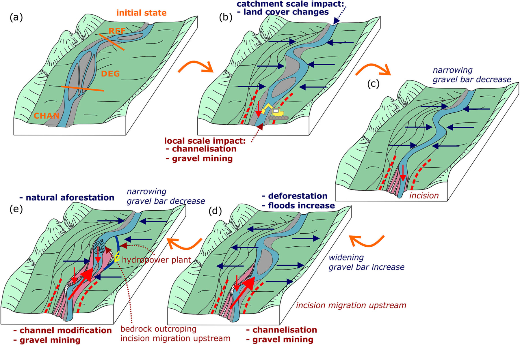
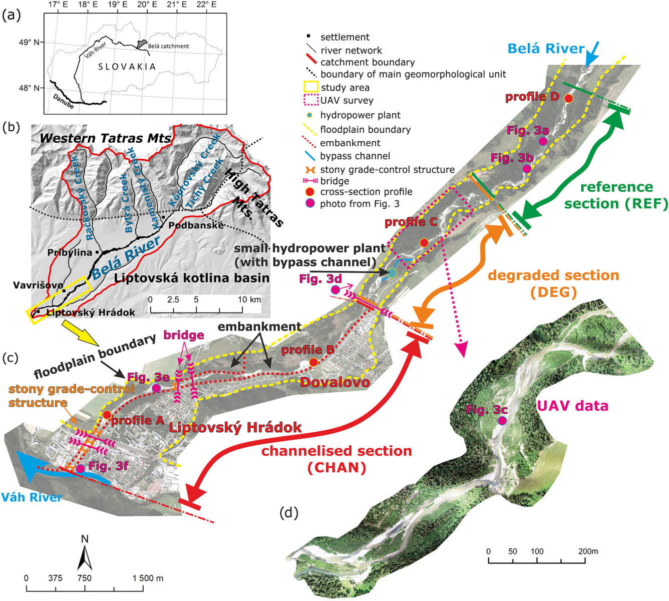
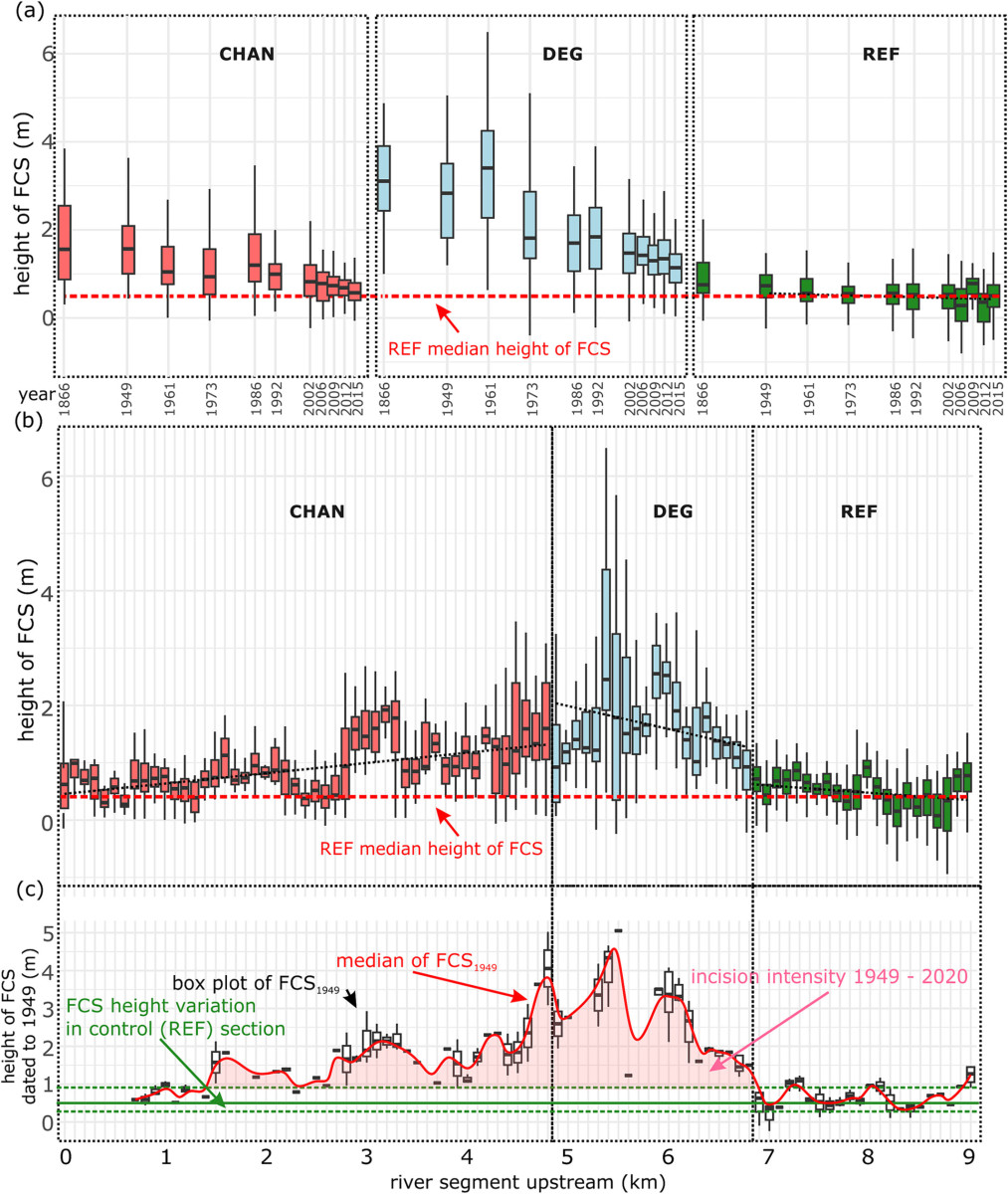
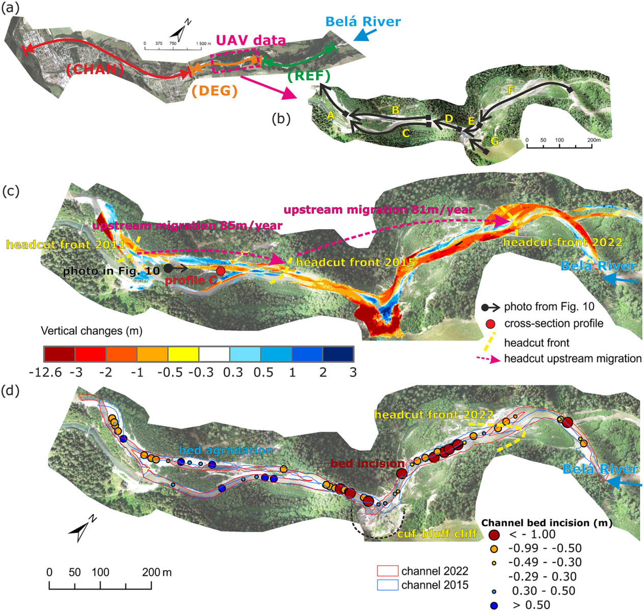
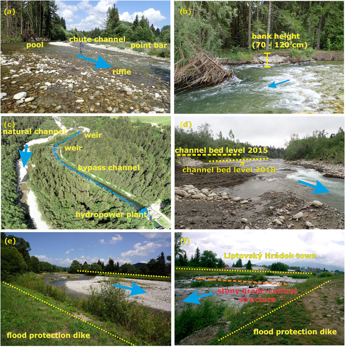
Channel incision is an evident trend for river evolution in many European rivers notably the Western Carpathians, whose former braided and multi-channel wandering river system is transforming into a single-thread channel. Paper Rusnák et al. (2024) answers questions about the natural channel transformation of the Belá River in Slovakia. Evaluate long-term channel pattern alterations using an innovative approach by a combination of aerial images, LiDAR data and drone mapping. The study was created in cooperation with the Institute of Geography UPJŠ Košice and the University ENS Lyon (UMR 5600 Environment Ville Société, CNRS) in France. The results quantify channel incision in some sections up to 4 m from 1949. Drone surveys confirm the erosion of 22,759 m3 of sediments between 2015-2022, roughly 3832 trucks.
The article Inferring channel incision in gravel-bed rivers: Integrating LiDAR data, historical aerial photographs and drone-based SfM topo-bathymetry was published in Earth Surface Processes and Landforms (Wiley) – IF 2022: 3.3
The article is part of the research projects:
- Assessment of human impact and climate change to the transformation of river channels using novel 3D geodata, [Grant Nr. 02/0016/24]
- Modelling urban heat islands using geospatial tools, [Grant Nr. 01/0085/23].
- Graduate School H2O’Lon (ANR-17-EURE-0018) of the Université de Lyon (UdL), which is part of the program “Investissements d’Avenir” run by Agence Nationale de la Recherche (ANR).
The products of airborne laser scanning are provided through the Geodesy, Cartography and Cadastre Authority of the Slovak Republic.