Assessing spatial patterns and the long-term evolution of river channel planforms is needed for understanding river behaviour and change.
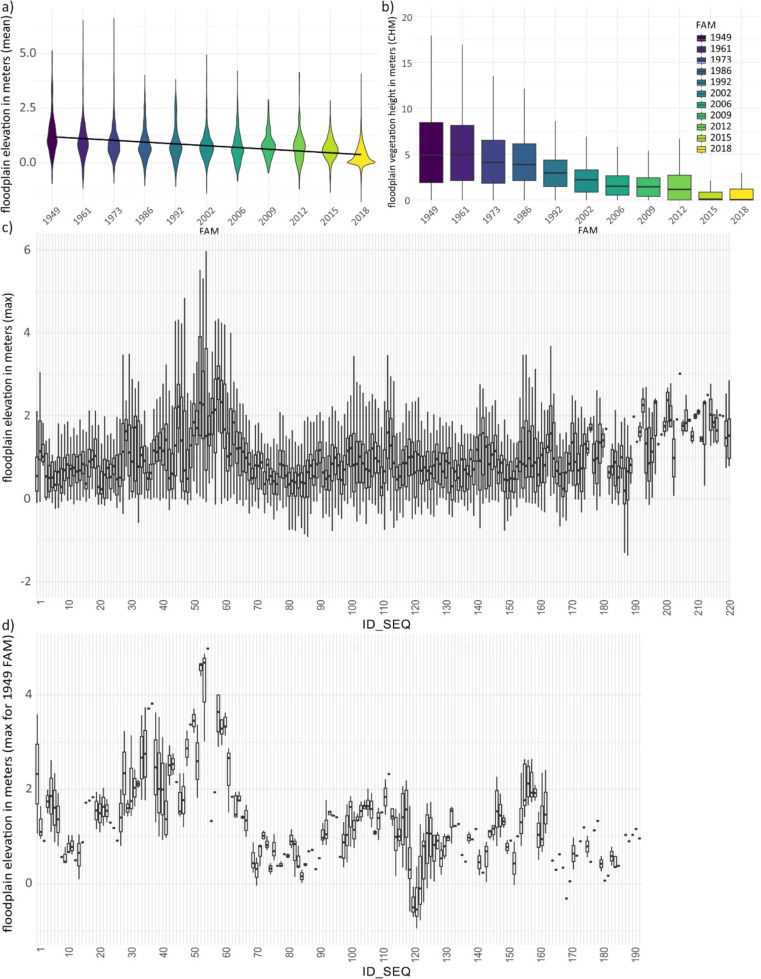
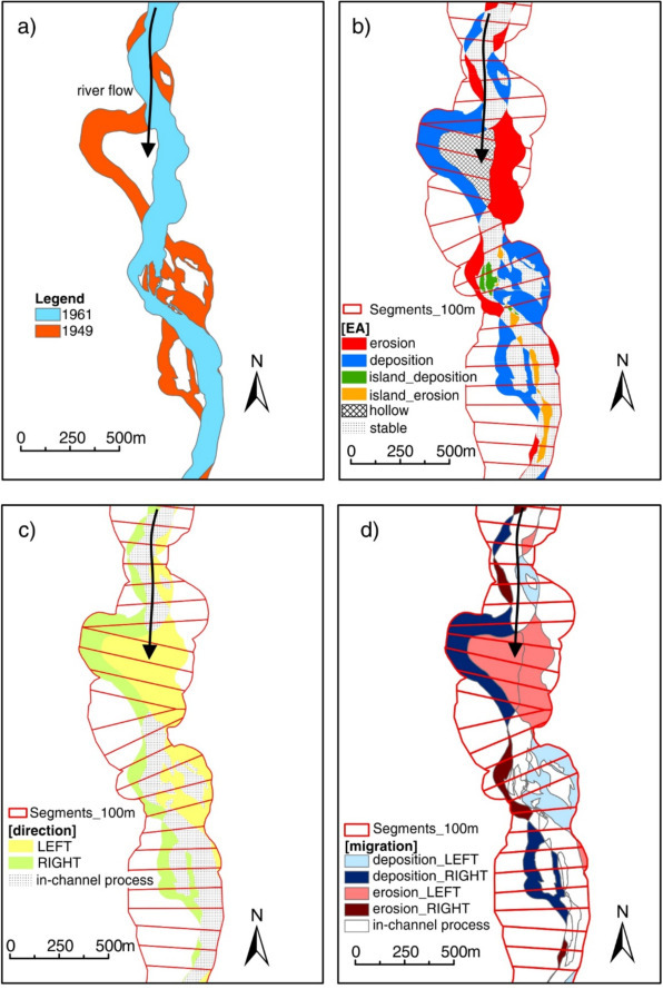
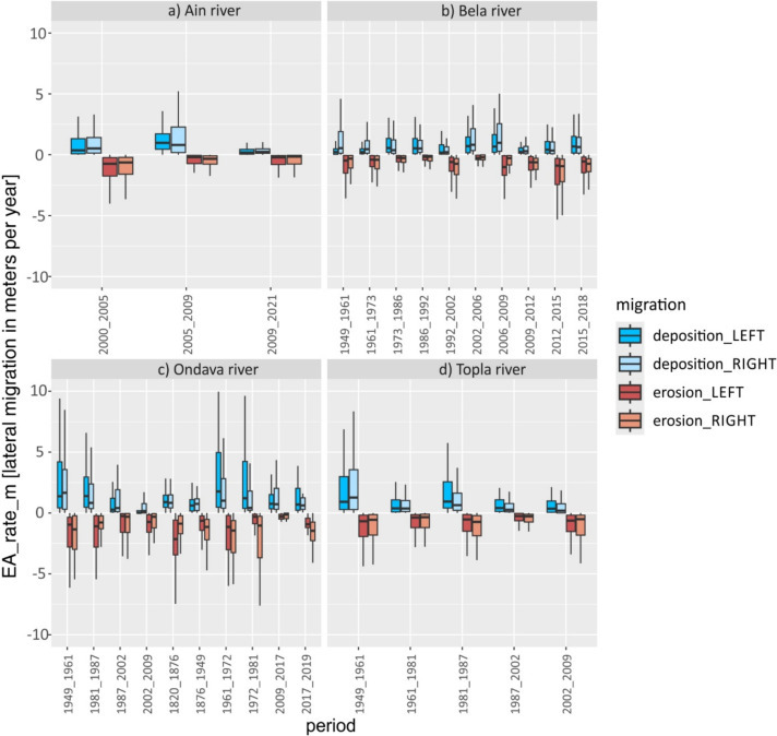
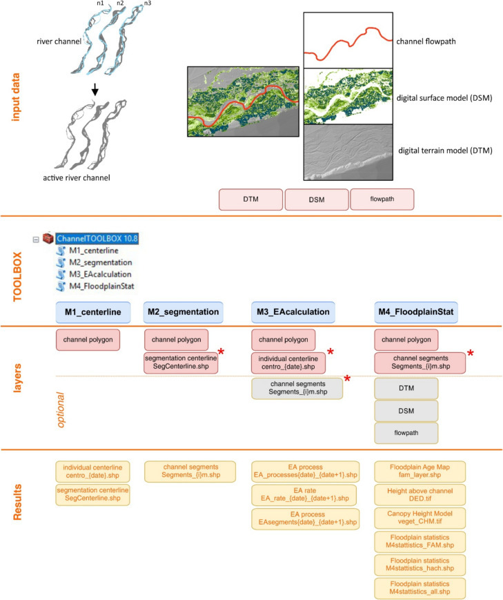
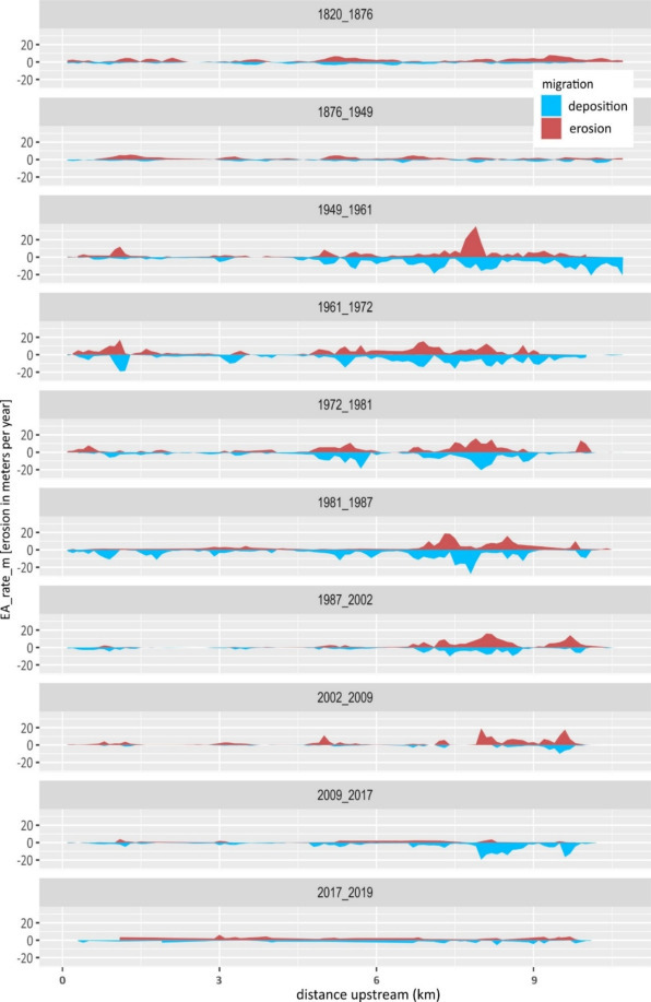
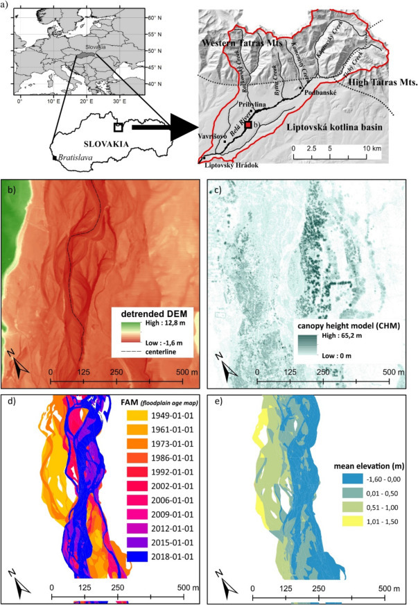
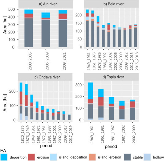
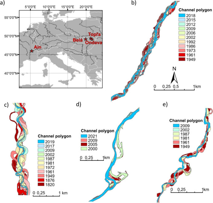
A new paper by Rusnák et al. (2025) presents the applications of a new toolbox: SCS Toolbox: Standalone channel shifting toolbox developed for ArcGIS software. The toolbox application supports the evaluation of spatial dynamics and lateral erosion by identifying channel migration and reach scale mobility. It also includes floodplain statistics based on combined LiDAR information, where height above the channel and vegetation canopy height are generated. The toolbox was tested on several river systems, some being sinuous (Ain and Topľa Rivers), meandering (Ondava River) or braided-wandering (Belá River). The study was created in cooperation with the university ENS Lyon (UMR 5600 Environment Ville Société, CNRS) in France.
The article A channel shifting GIS toolbox for exploring floodplain dynamics through channel erosion and deposition was published in Geomorphology (IF 2023: 3.1)
The article is part of the research projects:
- Assessment of human impact and climate change on the transformation of river channels using novel 3D geodata, [Grant VEGA No. 02/0016/24]
- 3D technology and machine learning methods for remote environmental monitoring and assessment of river health, [Contract no. APVV-23-0265].
- Graduate School H2O’Lon (ANR-17-EURE-0018) of the Université de Lyon (UdL), which is part of the program “Investissements d’Avenir” run by Agence Nationale de la Recherche (ANR).
Text: Miloš Rusnák