Historical aerial photographs are well known as a reliable source of information about historical land cover and land use. However, obtaining this information can be challenging due to the limited spectral characteristics of black-and-white images. Read on to find out how our colleagues on the Belá River tackled this task.
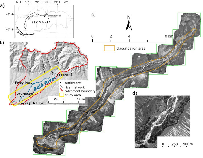
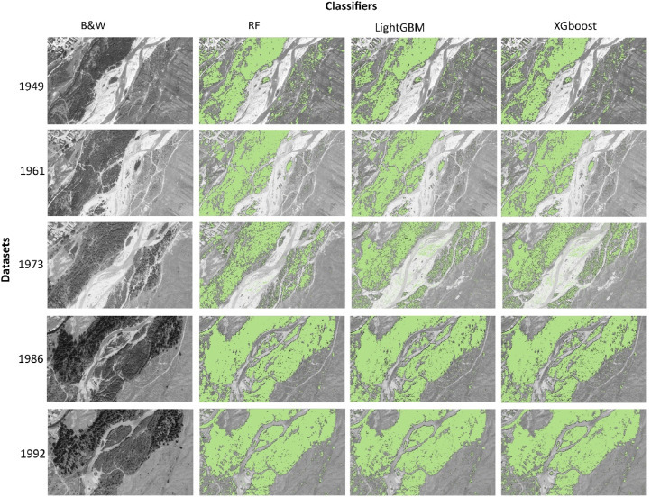
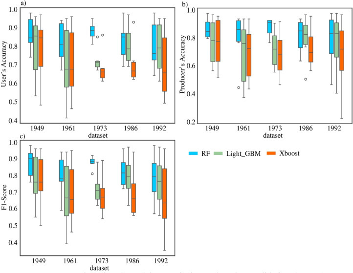
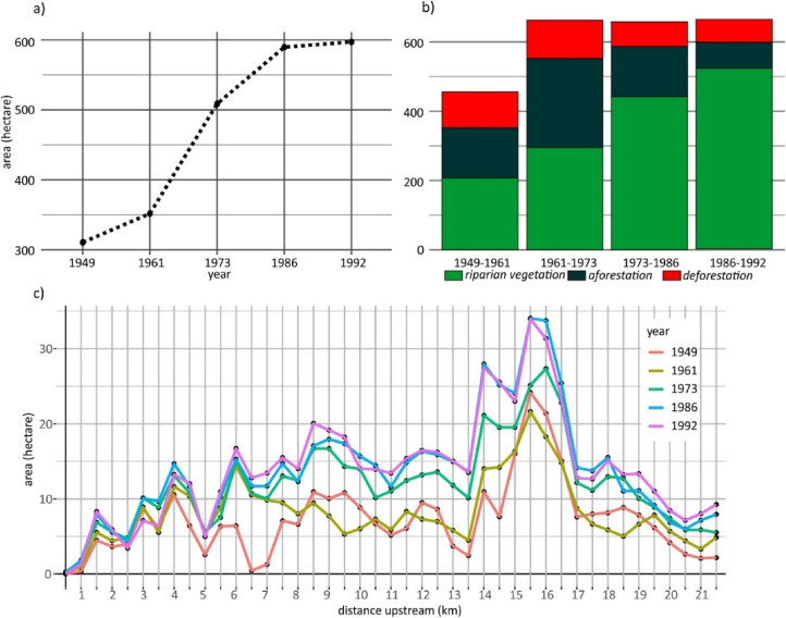
In this study, the authors evaluate a texture-based approach using machine learning models to detect the spatial pattern of a wild river system from historical aerial photographs, with an emphasis on riparian vegetation. Historical images capture the evolution of rivers over the last 75 years and are often the only source of information about past landscape development. The authors show that despite the limited spectral capabilities of these images, it is possible to reliably identify the spatial pattern of a wild, multi-branched river system with an emphasis on riparian (riparian) vegetation using textural methods and ensemble machine learning models. On high-quality processed and normalized orthophotomosaics of the Belá River (five time horizons: 1949, 1961, 1973, 1986, 1992), we extracted GLCM texture features and morphological operations (gradient, erosion, dilation, and others) and tested three common ensemble classifiers: Random Forest, LightGBM, and XGBoost. The most stable results were obtained by the Random Forest model, which achieved an overall accuracy of 90% and an F1 score of 89% on the test data, with the “forest” class being classified best; LightGBM and XGBoost achieved similar metrics, but XGBoost excelled in terms of calculation speed. Morphological features (especially gradient, eroded, dilated) proved to be key, surpassing classic GLCM metrics (e.g., contrast, entropy) in importance.
The articleEnsemble machine learning models for monitoring riparian vegetation dynamics using historical aerial orthophotos was published in the journal Remote Sensing Applications: Society and Environment (Elsevier) – IF 2024: 4.5
The article is part of the research projects:
- Assessment of human impact and climate change to the transformation of river channels using novel 3D geodata, [Grant Nr. 02/0016/24]
- 3D technology and machine learning methods for remote environmental monitoring and assessment of river health, [Contract no. APVV-23-0265].
- Doktogrant No. APP0461
Text: Miloš Rusnák, Hamid Afzali | Edited by: Tomáš Goga