Our colleagues Doc. RNDr. Matej Vojtek, PhD. and Soheyl Moradi, MSc. in cooperation with others colleagues published a research article at the end of 2024 dealing with the fluvial and pluvial flood hazard mapping.
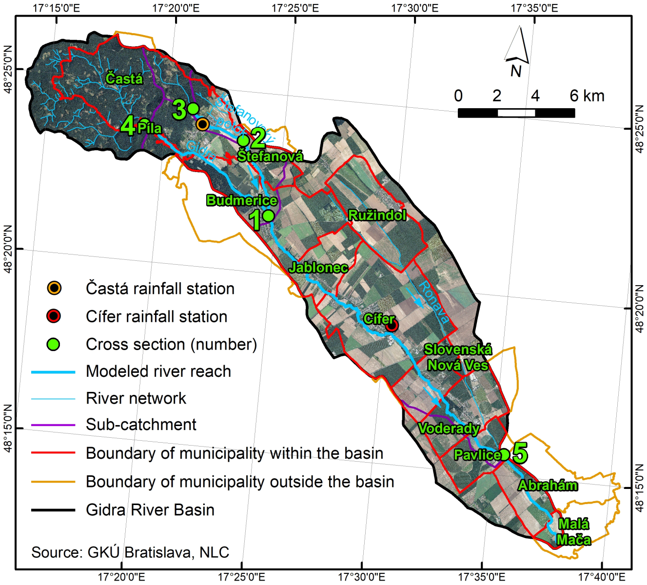
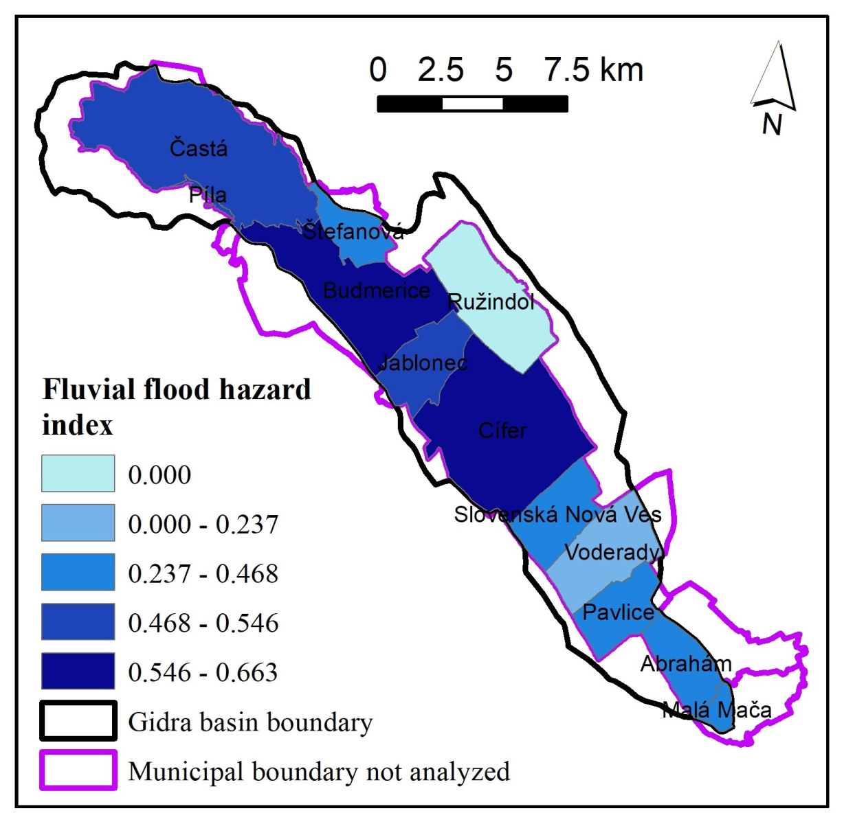
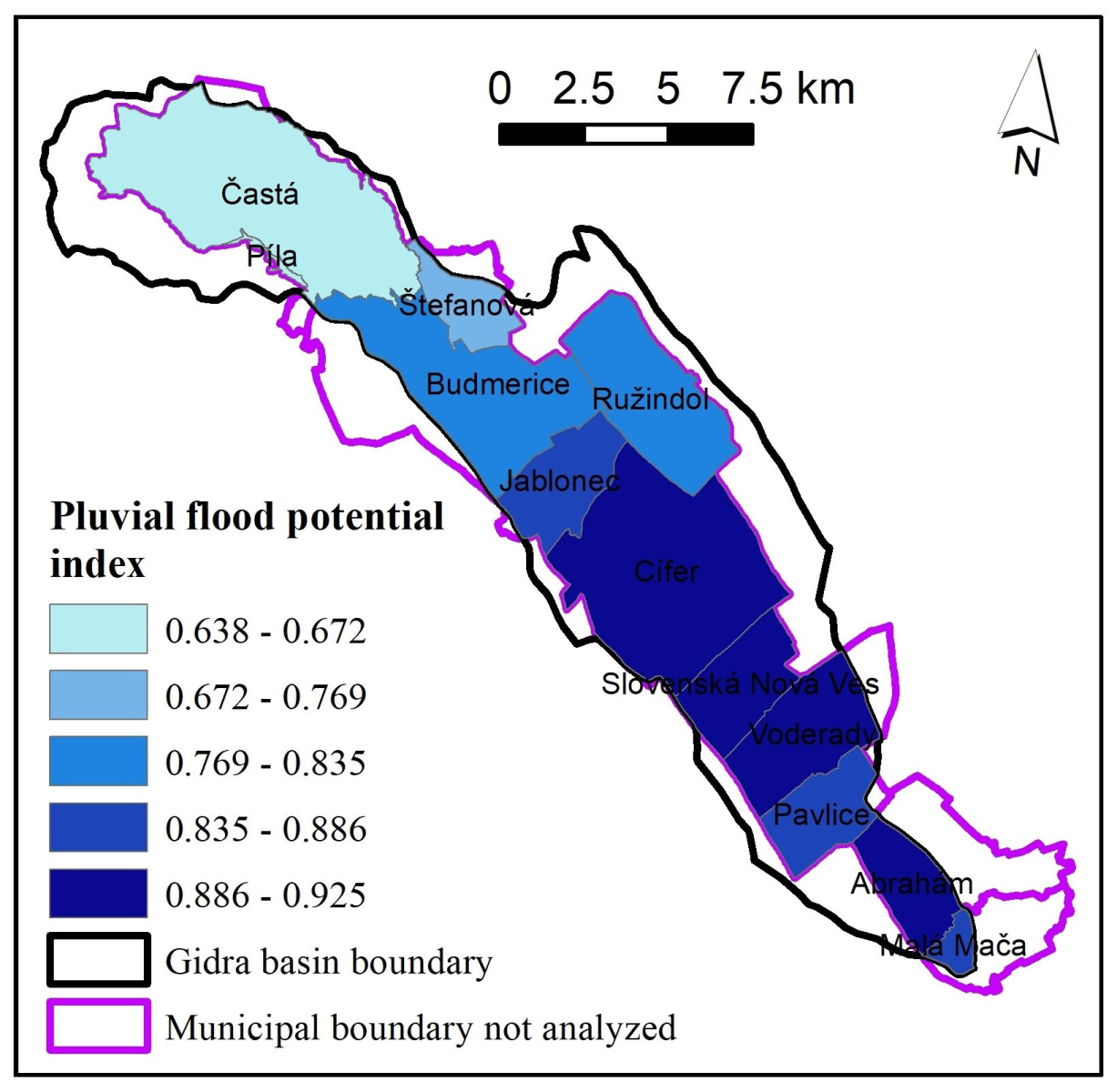
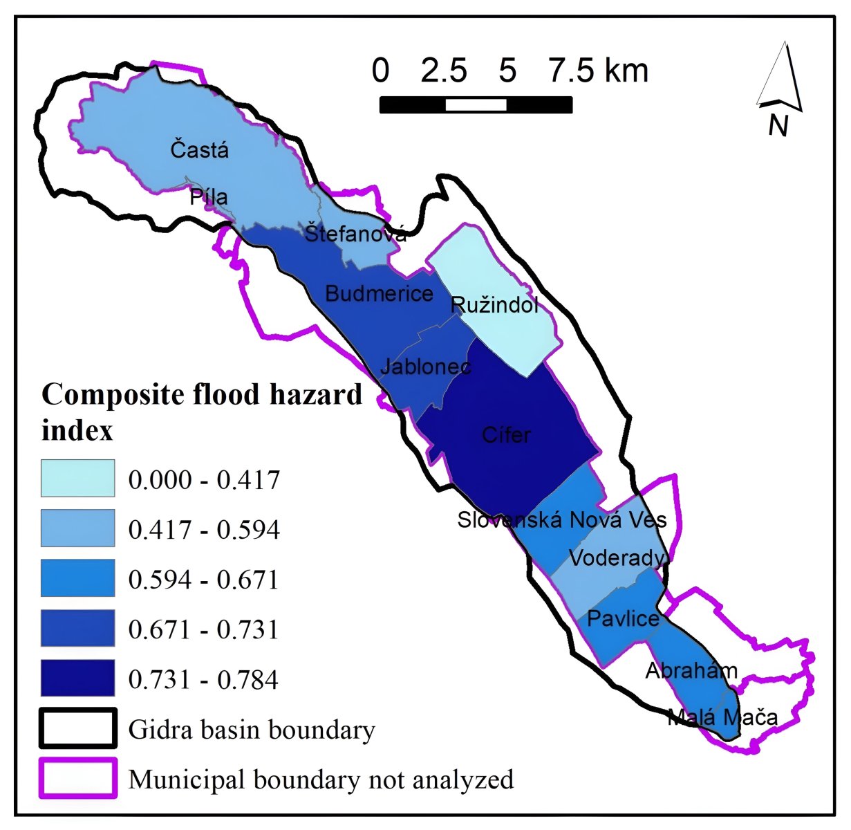
In the article, the authors focused on the mapping and assessment of fluvial and pluvial flood hazard in the Gidra River Basin, which includes 12 municipalities. Fluvial and pluvial flood hazard were first mapped within the entire basin using hydrologic-hydraulic modeling and geographic information systems (GIS). In the case of fluvial floods, the mapping at the basin scale resulted in maps of flood extent, flow depth and velocity for a flood with 100-year return period. Pluvial flood hazard was mapped at the basin scale using GIS, five physical-geographical factors and land cover. Subsequently, the results obtained within the entire basin were transformed into normalized indicators at the level of municipalities using GIS. We calculated indices for fluvial and pluvial flood hazard, synthesis of which yielded a composite flood hazard index in the municipalities of the Gidra River Basin. The results show that the municipalities most at risk from fluvial floods are the municipalities in the central and upper parts of the basin. In the case of pluvial floods, the most endangered are the municipalities located in the lower and middle parts of the basin. The highest values of the composite flood hazard index belong to the municipalities of Cífer, Budmerice, and Jablonec, which are located in the central part of the basin. The results were compared with the occurrence of previous flood events in the studied municipalities in the years 1996 – 2024, which confirmed the suitability of the methodology used.
The study also involved the Department of Geography, Geoinformatics and Regional Development, Constantine the Philosopher University in Nitra and the Italian workplaces: Department of Civil, Building and Environmental Engineering (DICEA), Sapienza University of Rome and Department of Agriculture and Forest Sciences (DAFNE), Tuscia University, Viterbo.
The article Fluvial and pluvial flood hazard mapping: combining basin and municipal scale assessment is freely available on the website of the journal Geomatics, Natural Hazards and Risk (IF 2023: 4.5).
The article is a part of the research within the projects:
- Recovery and Resilience Plan for Slovakia No. 09I03-03-V03-00085 with the title „Flood hazard mapping with the use of detailed geo-spatial data and hybrid approaches“.
Text: Matej Vojtek