Scientists from several European countries, including the Institute of Geography of the Slovak Academy of Sciences, have published an article in the prestigious journal Remote Sensing of Environment summarizing the latest findings on the use of satellite technologies to monitor the abandonment of agricultural land. The study, entitled “The progress and potential directions in the remote sensing of farmland abandonment,” offers a comprehensive view of how modern remote sensing (RS) allows for a better understanding of the changing relationships between humans and the landscape.
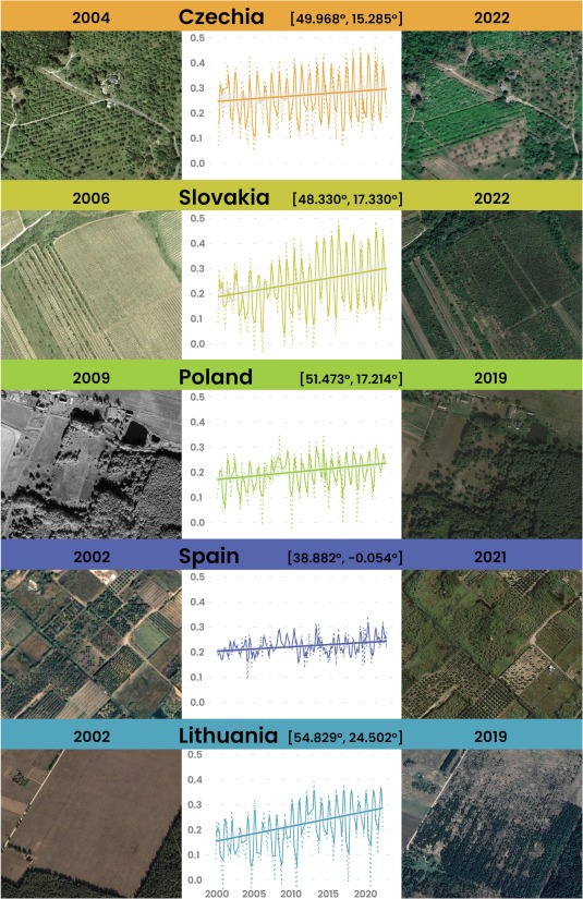
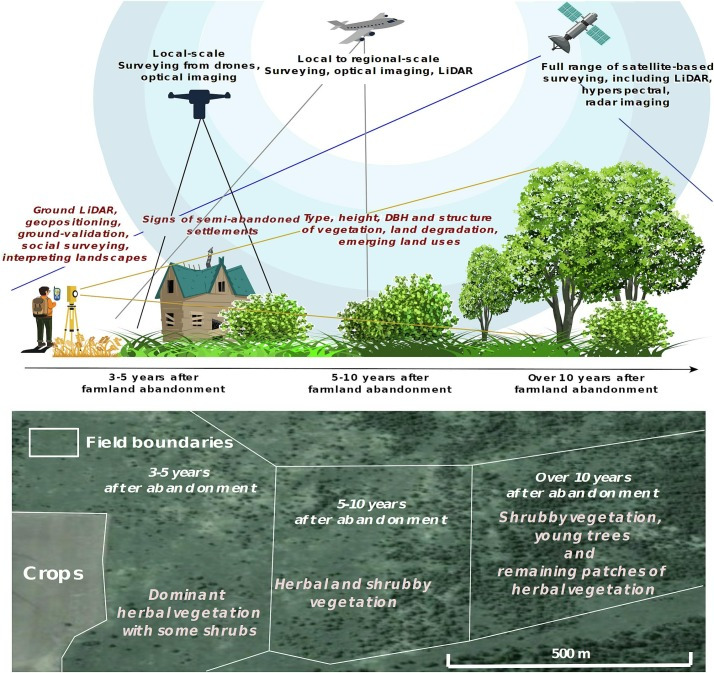
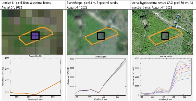
Our colleagues Ján Feranec, Tomáš Goga, and Róbert Pazúr, along with colleagues from Denmark, the Czech Republic, Poland, and Germany. The authors analyze how remote sensing methods have evolved over the past decade in mapping farmland abandonment, a phenomenon that affects much of Europe. They point out that satellite data from the Landsat and Sentinel programs can be used to track where agricultural activity is declining and where the landscape is changing into meadows, forests, or uncultivated areas. Modern methods based on machine learning make it possible to distinguish between natural succession and the economic or social decline of agriculture.
The abandonment of agricultural land is not just an environmental issue – it reflects social and economic changes. In some regions, it increases biodiversity and restores natural ecosystems, but in others it leads to overgrowth with weeds, the loss of traditional cultural landscapes, and the decline of rural communities.
This has several consequences for society:
- Better land planning: accurate satellite data enable municipalities and regions to identify areas that are losing their agricultural function and assess their potential for recultivation, ecological restoration, or new uses.
- Support for biodiversity: information on abandoned land helps to guide measures for nature conservation and increasing the ecological stability of the area.
- More effective use of European funds: data from remote sensing can support fairer allocation of direct payments and improve the EU’s Common Agricultural Policy, which often requires evidence of actual land use.
- Rural revitalization: Understanding trends in land abandonment helps policymakers and local authorities plan development projects that motivate people to stay in rural areas, for example, by supporting organic farming, agritourism, or landscape restoration.
- Prevention of environmental risks: satellite maps can highlight areas prone to fires, erosion, or invasive species, which often occur on uncultivated land.
Research indicates that integrating satellite data with artificial intelligence will enable near-real-time monitoring of landscape changes in the future. This means that national and regional institutions will be able to respond more quickly – for example, in crisis situations, environmental planning, or monitoring the use of subsidies. The research makes a significant contribution to understanding how the European landscape is changing – and how we can utilise these changes to benefit a sustainable, resilient, and viable society.
The article, led by Alexander Prishchepov, entitled The progress and potential directions in the remote sensing of farmland abandonment was published in Remote Sensing of Environment (Elsevier) – IF 2024: 11.4
The article is part of research within several projects, not only Slovak ones:
- SK-AAL – Advanced assessment of abandoned agricultural land in Slovakia [APVV-MVP-24-0386]
- Detection of landscape diversity in Slovakia and its changes based on remote sensing data in the context of the EU Green Deal [VEGA 2/0043/23]
Text: Tomáš Goga